MARINERO: A robot digital twin for autonomous navigation in nautical marinas
A digital twin of Marina Punat and the MARINERO robotic platform — built in ROS 2, Gazebo, RViz, and MapViz — for developing and evaluating autonomous driving, perception, and vessel inspection.
Albert Androšić, Luka Šiktar, Branimir Ćaran, Nino Dragičević, Jan Jakovljević, Marko Švaco
CRTA — Regional Centre of Excellence for Robotic Technologies Faculty of Mechanical Engineering and Naval Architecture (FSB), University of Zagreb Probotica d.o.o.
35th Int. Conf. on Robotics in Alpe-Adria-Danube Region (RAAD 2026)
Test autonomy in the marina — before deploying it there.
Deploying autonomous robots in dynamic, safety-critical places like a working marina demands a feasibility study first. MARINERO provides that environment: a high-fidelity digital twin of the marina and of the robot itself, so autonomous driving algorithms and platform efficiency can be evaluated in simulation before they ever touch the water's edge.
The project pairs a digital twin of Marina Punat (island of Krk) with a digital replica of the MARINERO patrol platform and its full sensor suite. Together they form an evaluation testbed for autonomous patrolling — including vessel detection, identification, state monitoring, and raising marina security standards.
5,000,000Point-cloud points
4WIS4WIDRobot drive platform
3Steering modes
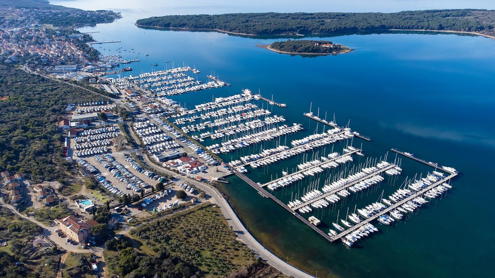
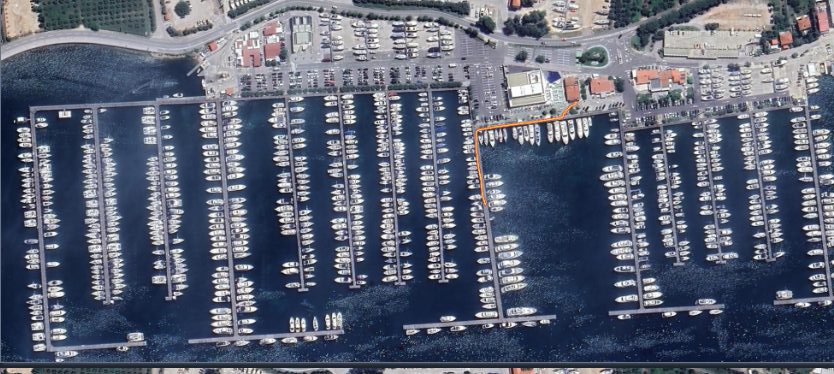
Marina Punat — the real environment behind the digital twin. Source:otok-krk.org
Digital twin · Marina Punat
From a 5-million-point cloud to a simulated marina.
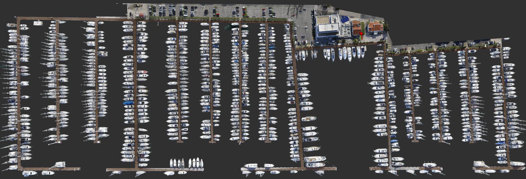
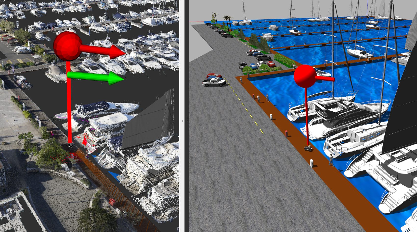
The marina was captured as a 3D point cloud by UAV (lab. Avyonx, FER, Croatia) and converted to SDF using CloudCompare. With five million points, it reproduces the real-world returns of the 2D and 3D LiDARs mounted on MARINERO — and is visualized in RViz and simulated in Gazebo.
The 5 M-point cloud of Marina Punat, recorded by UAV and visualized in RViz (ROS 2).
Gazebo world
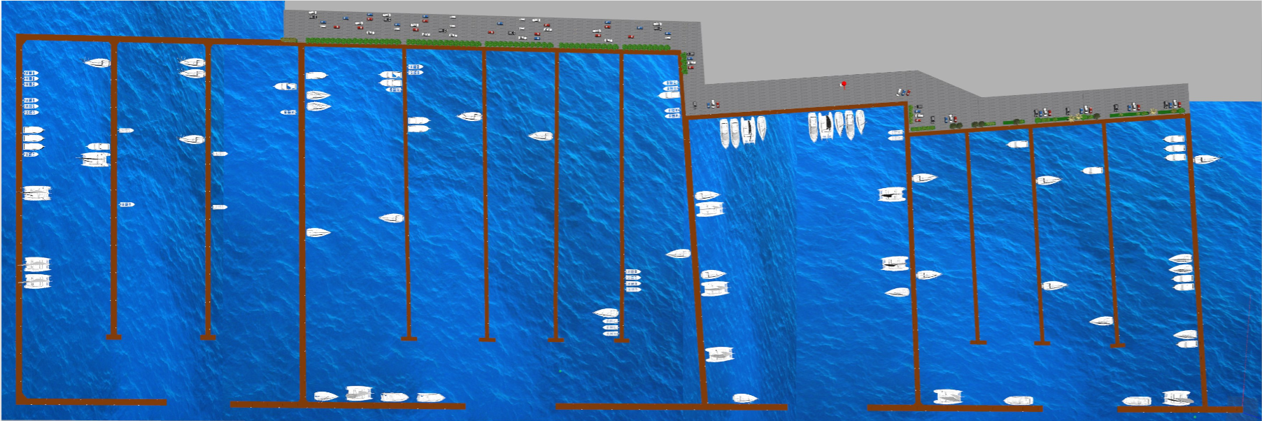
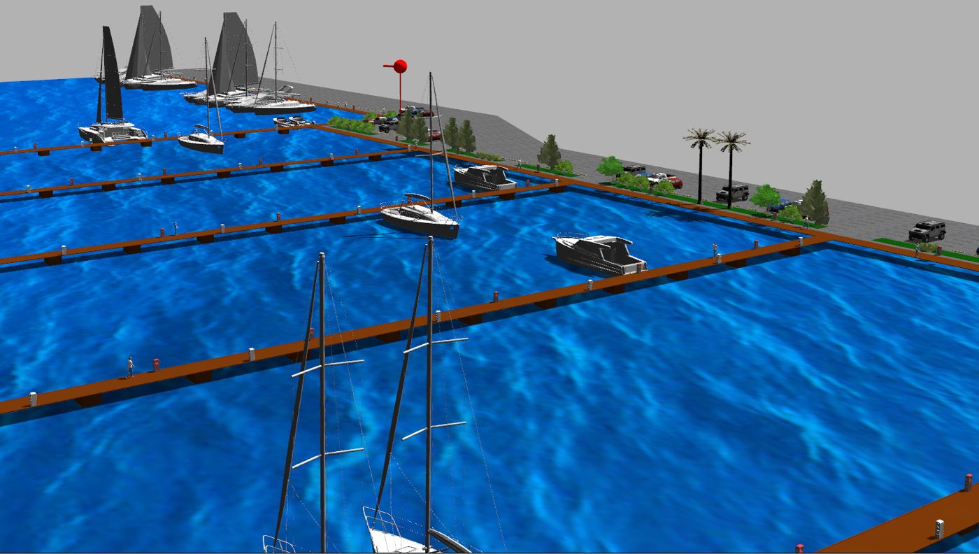
Structural parts (docks, pathways) were modeled in AutoCAD, Blender, and the Gazebo Editor; vessels came from CAD models routed through Blender; people, trees, and vehicles from the Gazebo model library; and dockside electrical and water cabinets from Inventor and Blender.
Marina Punat in Gazebo.
The marina reconstructed as a Gazebo world.
GPS georeferencing
A marina GPS map is correlated with Gazebo and RViz for precise tracking of the platform in a global coordinate system. A GPS plugin plus the mapviz package visualizes GPS data in real time against the reference satellite map and the other sensors.
GPS tracking over the satellite reference map.
Platform · MARINERO robot
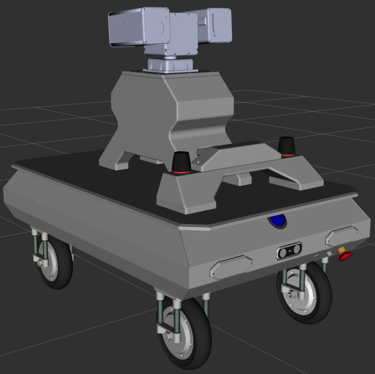
A 4WIS4WID platform with a full perception suite.
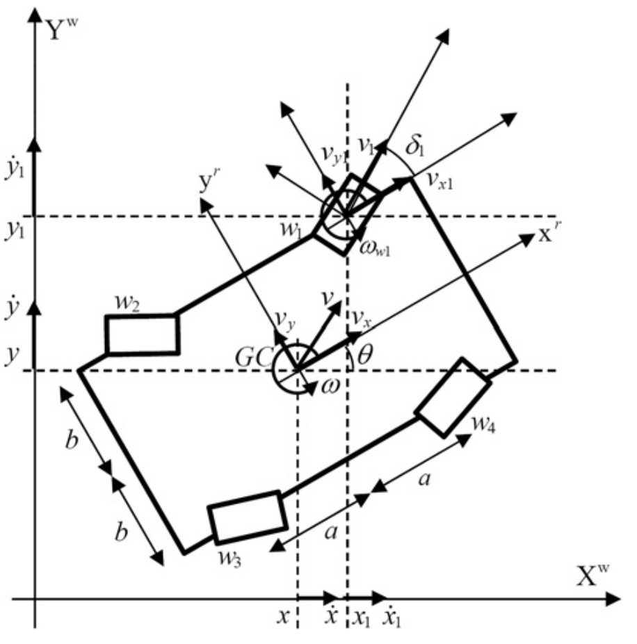
The four-wheel independent steering, four-wheel independent drive (4WIS4WID) chassis enables lateral movement, in-place rotation, and navigation through the narrow spaces of a marina.
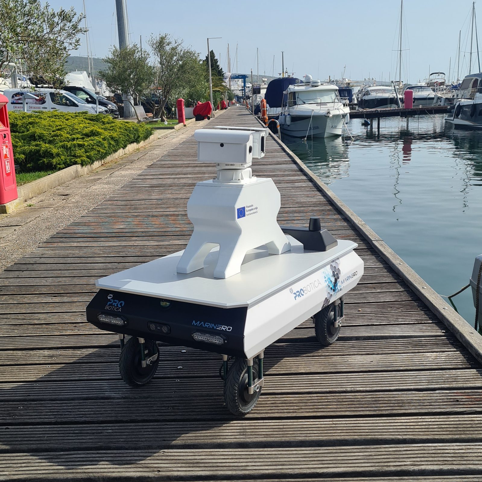
Digital twin of MARINERO with its full sensor suite.The MARINERO platform (Probotica d.o.o.) at Marina Punat, island of Krk, Croatia.
Control & navigation
Trajectory tracking
Model Predictive Control
An optimal control–based algorithm, with a time-varying Linear Quadratic controller for trajectory tracking.
Autonomous navigation
MPPI + DWB
A Model Predictive Path Integral controller configured for Ackermann geometry, with the DWB local planner over costmaps from the 3D marina model.
Maneuvering
3 steering modes
In-phase steering, opposite-phase steering, and pivot turn — selected for the maneuver at hand.
Kinematic model of the 4WIS4WID platform — body frame and the four independent steer/drive wheels.
Localization & visualization
RViz, Gazebo, and MapViz, in sync.
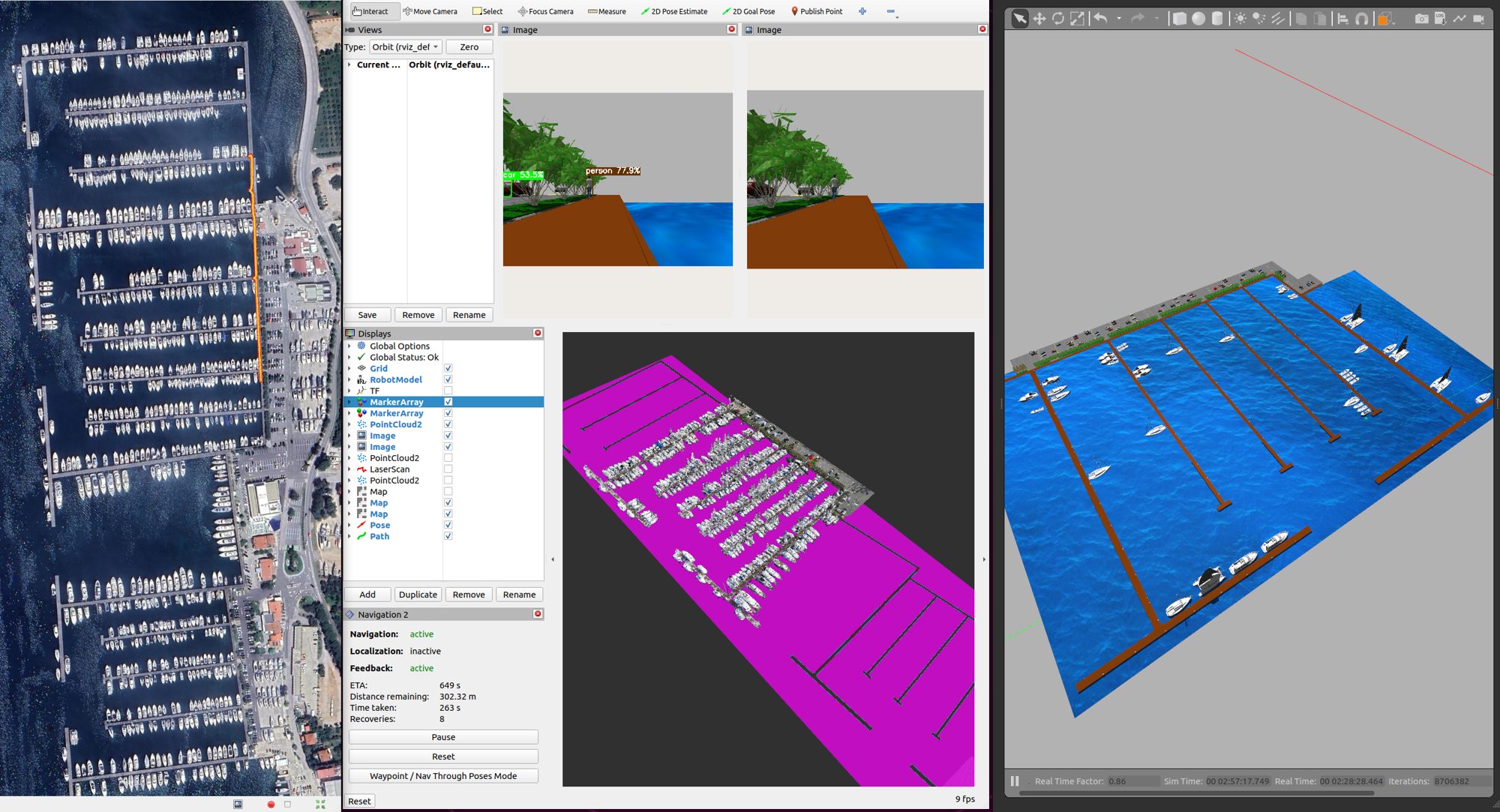
Synchronous communication links the RViz visualizer, the Gazebo simulator, and MapViz. The platform's position is shown in both RViz and Gazebo, with markers for the current robot location (/odom), heading, and PTZ camera direction. Simulated GPS is overlaid on the satellite image of Marina Punat.
Platform position and heading across RViz, the Gazebo simulator, and MapViz. Heading markers (red) and PTZ camera direction (green) are georeferenced over the marina.
Perception
Object detection inside the digital twin.
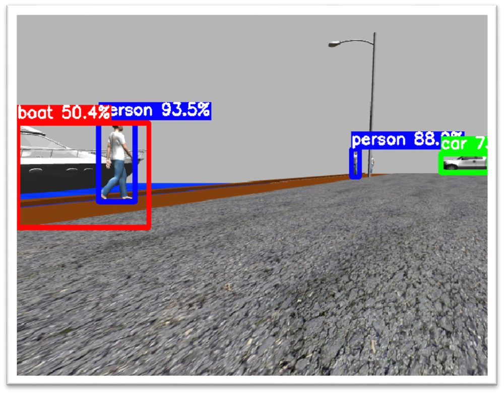
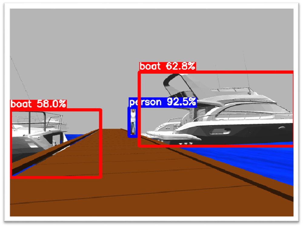
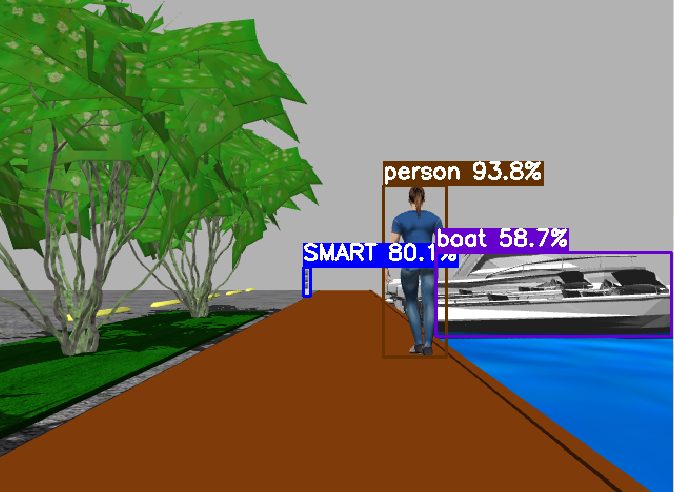
A custom YOLOv8 model — trained on 400 images split 80:10:10 (train:test:val) — detects people, vehicles, vessels, and electrical and water cabinets within the simulated marina. On a detected vessel, the PTZ camera centers the target and captures an inspection image.
0.867Precision
0.732Recall
0.803mAP
400Training images
People & cabinets.Vessel & zone.Mixed scene.
Application
Automated vessel inspection, end to end.
A complete mission flow, from a staff request to a returned inspection report.
The owner or marina staff requests an inspection at specific GPS coordinates.
Using MapViz, the GPS coordinates are transformed to a pose on the marina map.
The robot plans a path to the pose derived from those coordinates.
The robot executes the mission with online obstacle avoidance.
Vision sensors detect the target vessel and capture inspection images.
The inspection report is sent back to the owner or marina staff.
System
The full pipeline at a glance.
End-to-end pipeline — MapViz georeferencing, robot trajectory, raw camera, YOLOv8 detection, costmap (RViz), and the Gazebo simulator.
The open-source stack
The implementation ships as ROS 2 packages in the marinero_stack meta-repository.
01
marinero_simulations
Gazebo digital twin, robot description, and the Marina Punat world.
02
marinero_control
4WIS4WID and differential-drive controllers on ros2_control.
03
robot_localization
Sensor-fusion localization across odometry, IMU, and GPS.
04
marinero_pointclouds
LiDAR point-cloud processing for perception and mapping.
05
marinero_navigation
Autonomous navigation: MPPI control and DWB local planning.
06
goal_assignment
Waypoint goals, including requests from the companion app.
07
mapviz
Georeferenced GPS and telemetry visualization.
Run the simulation
01 Full Gazebo simulation (4WIS4WID via ros2_control.xacro)